


The Civic Innovation Hub (CIH) organizes residents and local governments of the Calumet Region in the south suburbs of Chicago with the purpose of achieving community-led results on critical social, economic, and environmental infrastructure. With a focus on resilient stormwater management, CIH provides educational curriculum, data analysis and tools, community advocacy and knowledge-building resources, and networking opportunities.
CNT partnered with Ramont Bell at Faith in Place to recruit participants in the Calumet River Corridor. Over 8 months, CNT worked with Maggie Catania from the Calumet Collaborative and Dr. Rachel Scarlett through the Field Museum’s Keller Science Action Center to develop a learning curriculum around resilient stormwater management and community organizing. Each resident-led cohort developed a capstone project specific to their community.
Featured below are the agendas, presentations, and additional resources from each session, available to you in hopes that they may provide help in organizing and building resilient stormwater infrastructure with your community.
Session 1: Stormwater Management 101
The first session provided foundational knowledge about stormwater management, defined key terms and concepts, and created space for people’s experiences with flooding. Then, cohort members used the urban flooding baseline tool to explore flooding around a location they frequented.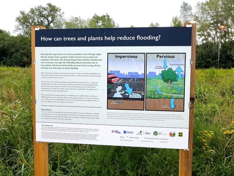
-
Session Materials
- Agenda (PDF)
- Presentation (PDF)
- Resources (PDF)
- Summary (PDF)
Session 2: Community Organizing
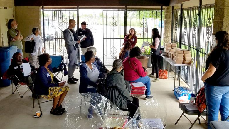
A guest presenter, Olga Bautista, a community organizer from the Southeast Environmental Task Force, focused on the power of residents organizing to improve their community and shared local success stories. Energized by the presentation, cohort members discussed initiatives happening in their own municipalities that could be models and founding blocks for broader community organizing.
-
Session Materials
- Agenda (PDF)
- Presentation; (PDF)
- Resources (PDF)
- Summary (PDF)
Session 3: Asset Mapping
Mario Longoni of the Field Museum led an activity to create asset maps. Community asset maps locate the institutions, people, organizations, places, and other local resources identified by residents. Asset maps inform project or program planning by establishing what’s valued in the community and building in harmony with those existing resources. Some cohort members attended an optional training session the week prior to help facilitate their community’s collective map-building exercise.
-
Session Materials
- Agenda (PDF)
- Presentation (PDF)
- Demonstration Jam Board (PDF)
- Community Specific Jam Board (PDF)
- Resources (PDF)
- Field Museum Resources on Asset Mapping (PDF)
- Summary (PDF)
Session 4: Municipal Planning and Financing
Notably, the Chicagoland area experienced extreme flooding just ahead of the fourth session, so the workshop created space to discuss cohort members’ experiences. The session then delved into the topics of municipal financing and climate planning. Presenters shared what funding resources municipalities generally depend on and what staff supports those activities. Finally, a group of guest panelists including government leaders, staff, and advocates provided further insights. Panelists included: Bernard Ward, Previous Director of Public Works in the Village of Robbins; Betty Ervin-Robinson, Riverdale Park District Board President; and Brandon Evans, CNT’s Outreach and Engagement Manager.
-
Session Materials
- Agenda (PDF)
- Presentation (PDF)
- Resources (PDF)
- Summary (PDF)
Session 5: Capstone Session 1
In response to the flooding before the previous session, the U.S. President declared a federal disaster, which released funding for the affected Chicagoland areas. Therefore, facilitators covered how residents could safely access FEMA aid. Cohort members then began ideating on their respective capstone projects using the prepared capstone project worksheet. Groups reviewed their community asset maps to think through how the assets could help support stormwater management in their communities. They discussed current challenges and began identifying possible project ideas that could fill those gaps while building on current assets.
-
Session Materials
- Agenda (PDF)
- Presentation (PDF)
- Sample Capstone Project Worksheet (PDF)
- Data FAQ1 (PDF)
- Data FAQ2 (PDF)
- Resources (PDF)
Session 6: Field Trip 1
The cohort went on a field trip to Alsip, IL to observe and experience a large-scale green stormwater infrastructure site at a public boat launch facility on the Calumet-Saganashkee River. Participants learned about project implementation and maintenance from OAI, Inc, the Village of Alsip, and the Metropolitan Water Reclamation District (MWRD). After touring the site, cohort members continued working on their capstone project worksheets.
Session 7: Field Trip 2
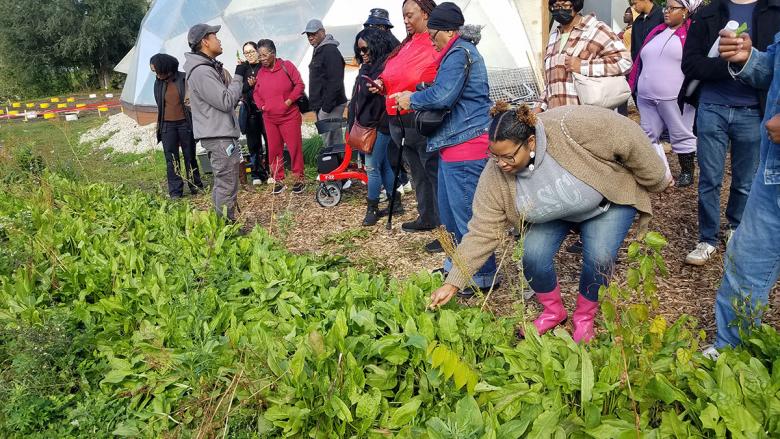
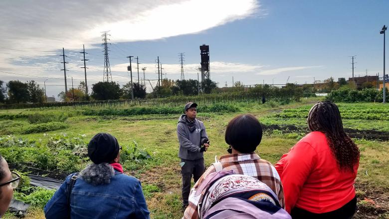
The cohort went on a field trip to the southside of Chicago to learn about other examples of green stormwater infrastructure. The trip highlighted a variety of ways green stormwater infrastructure could be implemented in more densely populated areas. They toured a working urban farm in South Chicago operated by Urban Growers Collective and visited a Space to Grow schoolyard at Ninos Heroes Elementary.
Session 8: Final Capstone Session
The final session provided an opportunity for participants to debrief following the two field trips. Most of the session was dedicated to finalizing capstone projects and developing an action matrix to inform each community’s next steps on their project. Participants also learned about two continuing efforts (Faith in Place Green Teams and RainReady Steering Committees with invitations to participate. To close the last session, the group shared their final reflections on the program.
-
Session Materials
- Agenda (PDF)
- Presentation (PDF)
- Resources (PDF)
- Glossary (PDF)
CNT’s Next Steps
CNT is in the process of initiating implementation of community capstone projects by:
- Incorporating them in to the RainReady project
- Identifying and submitting proposals to funding opportunities with organizational partners
- Keeping connected with residents
Watch our website for any updates!