


Interactive Tools
We develop research tools to help planners, developers, and community leaders make smart, data-driven decisions.
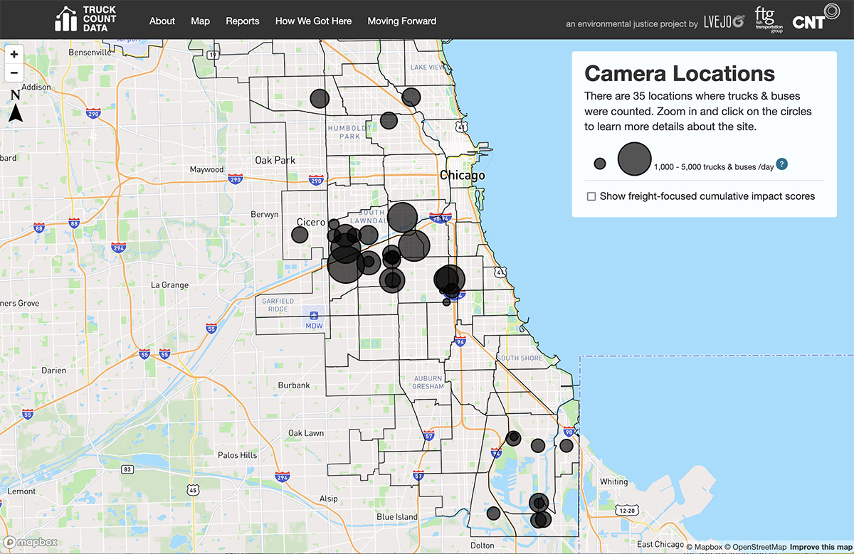
Chicago Truck Data Portal
CNT and the Little Village Environmental Justice Organization counted trucks and buses throughout Chicagoland. The counts available through this open-source portal shine a light on the problem of high truck traffic in environmental justice communities.
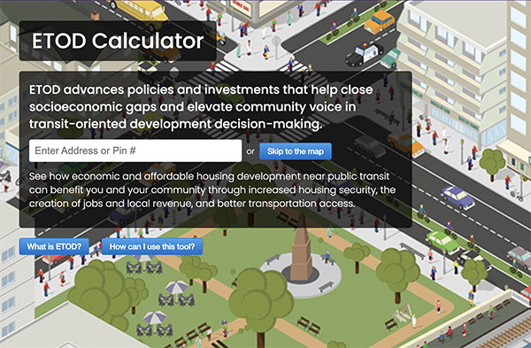
ETOD Social Impact Calculator
Discover the social and economic impacts of your affordable housing development and the benefits of locating it near transit.
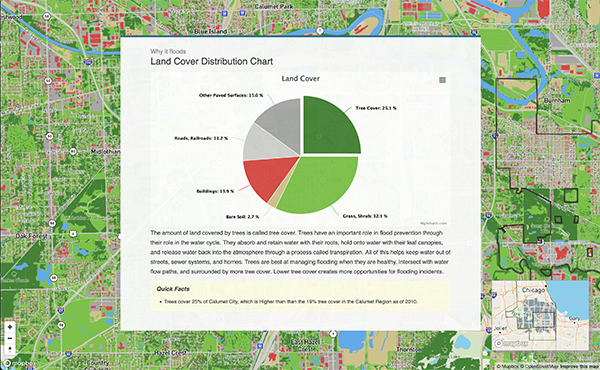
The Urban Flooding Baseline Project
A quantitative and qualitative look at urban flooding in the Calumet Region of Cook County.
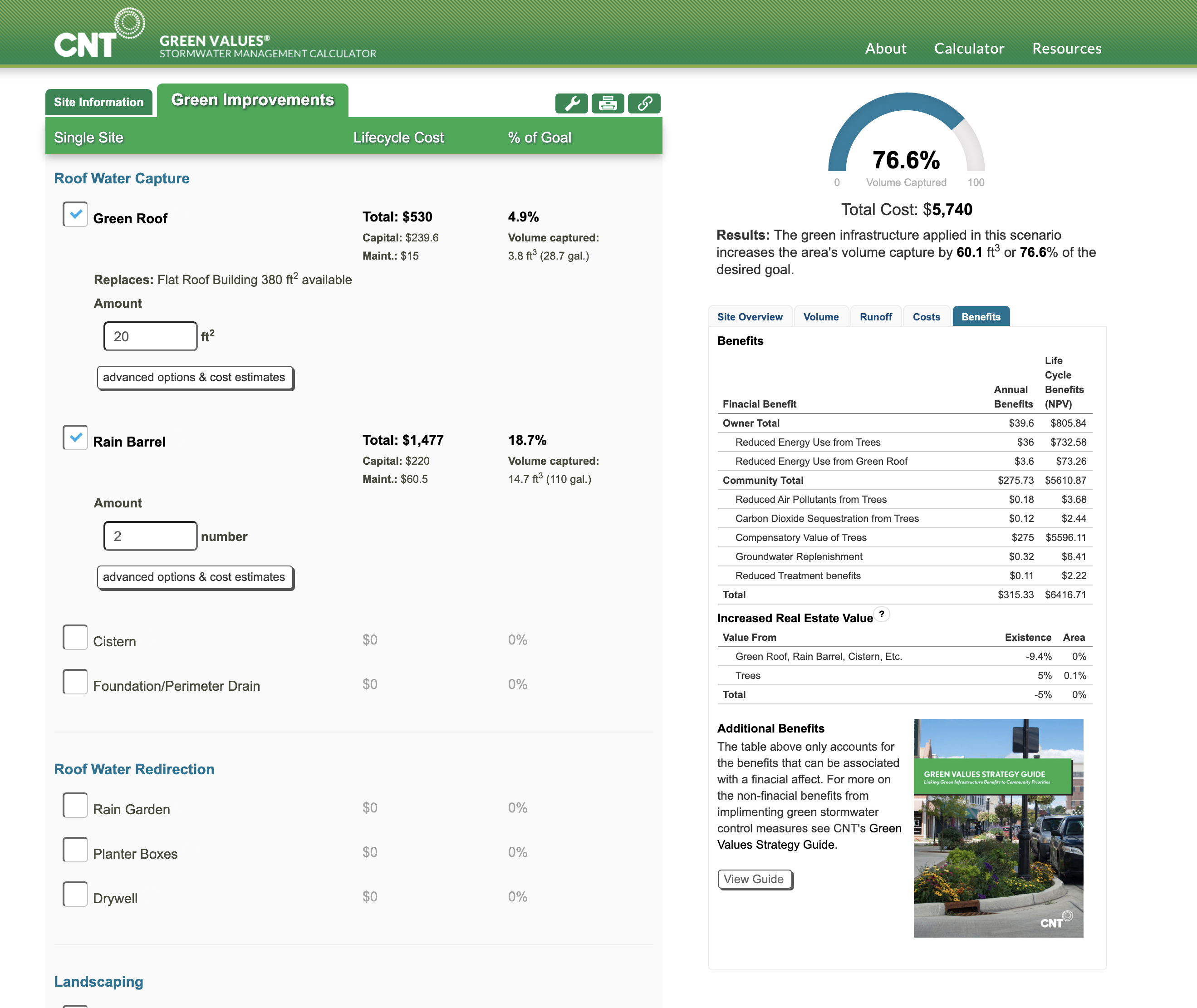
Green Values Calculator
The Green Values Calculator compares the performance, costs, and benefits of Green Infrastructure to conventional stormwater practices.
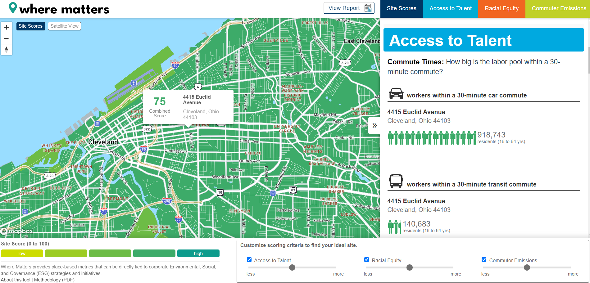
Where Matters
Where Matters reveals the hidden insights that support more equitable, sustainable communities in Northeast Ohio—and across more than 380 metros nationwide.
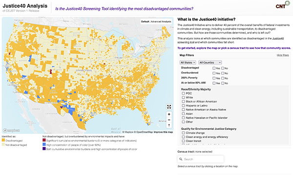
Justice40 Analysis Tool
Is the Justice40 Screening Tool identifying the most disadvantaged communities?
Washington Transit Access Map
The Washington Transit Access Map allows you to look up information about the type of transit service available in any location in Washington State. The map is tool for advocates, planners, policymakers, researchers, and students interested in understanding where transit is frequent and reliable, who has access and who doesn't.
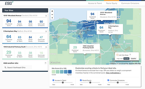
ESGP: Ohio Site Selection Tool
The Power of Place: This new mapping tool helps compare potential development sites' impact on ESG goals.
Virginia Transit Tool
Explore New Transit Impact Measures for Virginia’s People and Jobs.
AllTransit™
AllTransit™ is the largest source of transit connectivity, access, and frequency data in America. It offers tremendous potential for planning applications to increase our understanding of the value of transit, as well as to enhance service and operations planning.
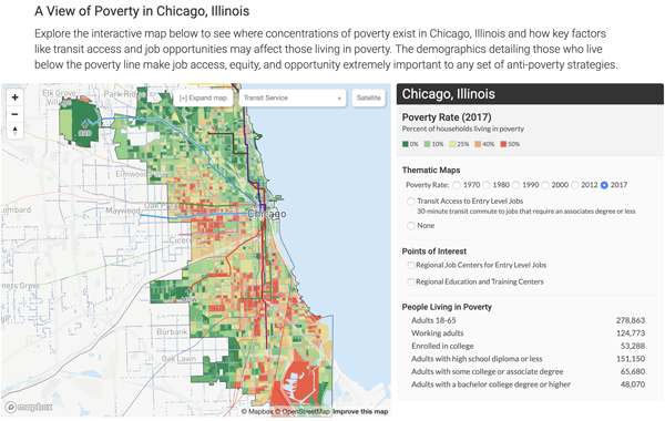
Urban Opportunity Agenda
The Urban Opportunity Agenda website offers ideas and metrics for simultaneously combatting poverty and promoting urban sustainability.
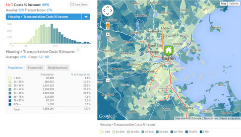
Housing + Transportation Index
The Housing + Transportation (H+T®) Affordability Index provides a comprehensive view of affordability that includes both the cost of housing and the cost of transportation at the neighborhood level.
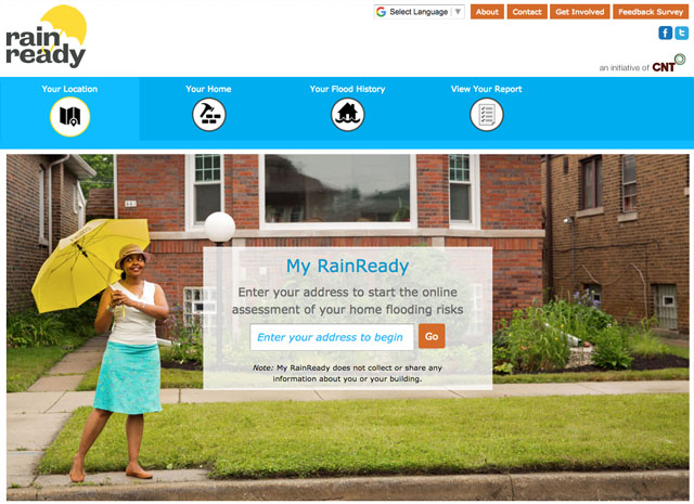
My RainReady℠ Home Assessment Tool
Is your home ready for increased storm events in a time of climate change? My RainReady helps you discover what issues you may have, and how you can address them.
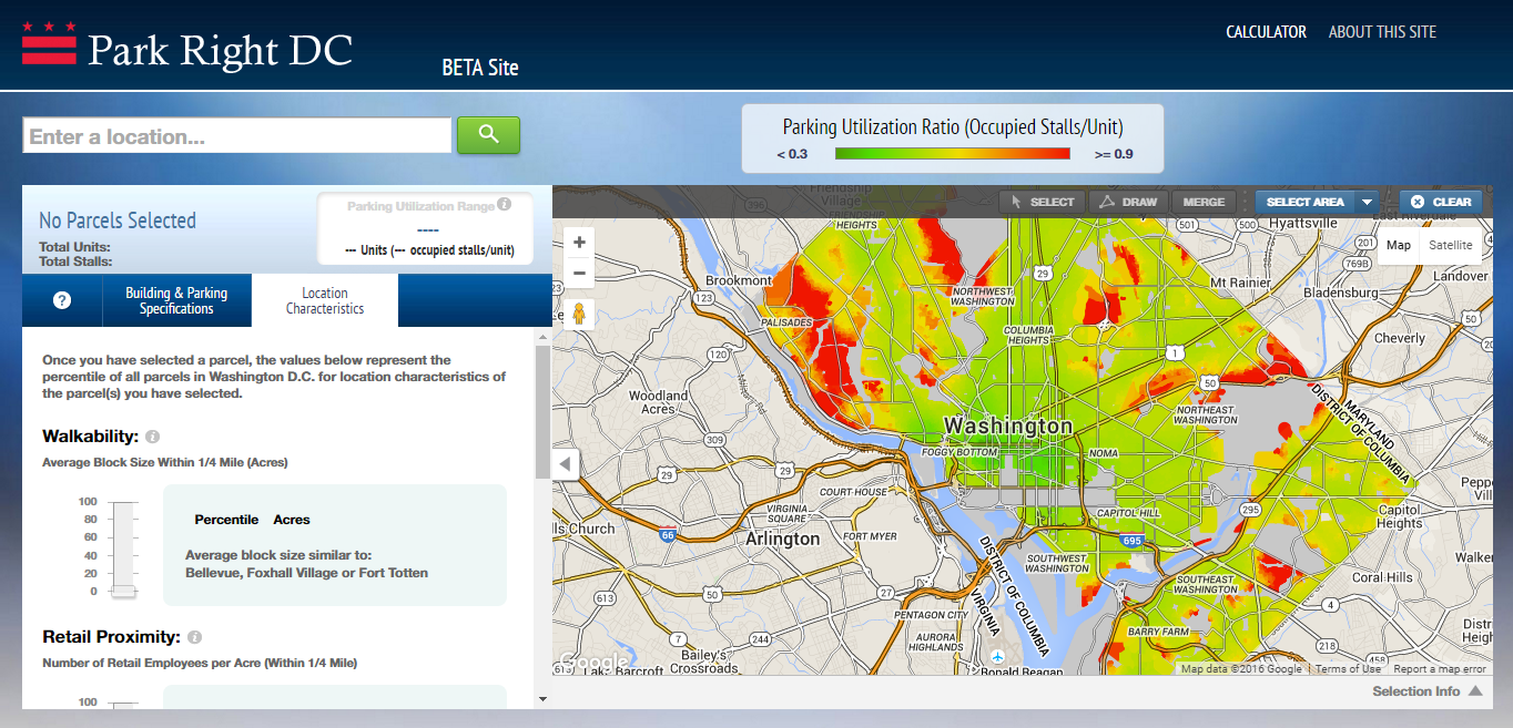
Park Right DC
Client: District Department of Transportation
The Park Right DC calculator helps community members, developers, zoning bodies, planners, and other stakeholders better understand parking utilization in multi-family residential buildings in the District of Columbia.
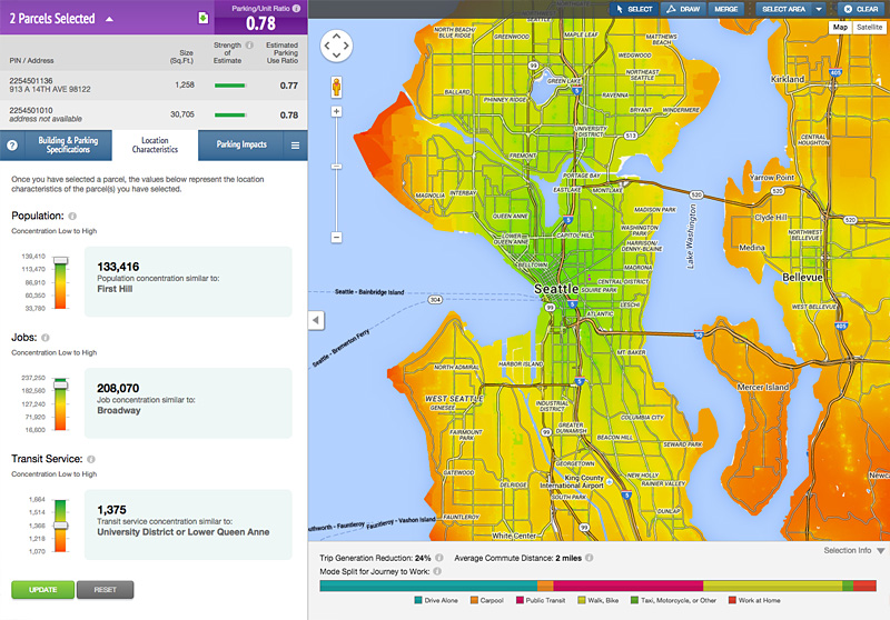
Right Size Parking Calculator
Client: King County, Washington
The King County Right Size Parking Calculator provides estimated parking/unit ratios for multi-family developments throughout urban areas of Seattle’s county.
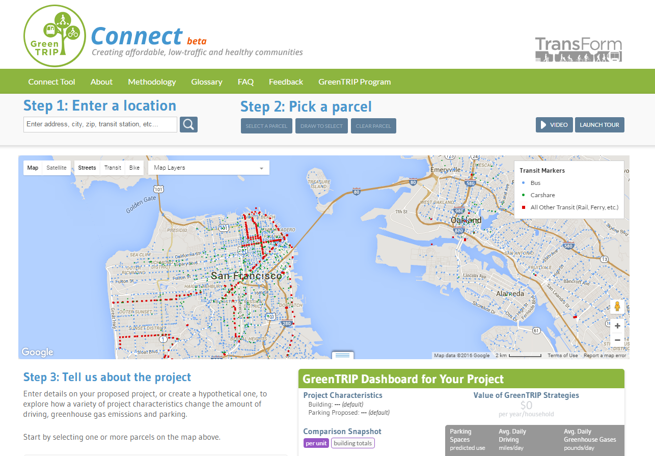
GreenTRIP Connect
Client: TransForm
GreenTRIP Connect is a California statewide tool that allows users to evaluate a prospective housing development’s potential to reduce greenhouse gas emissions due to driving.
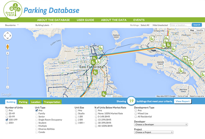
GreenTRIP Parking Database
Client: TransForm
The GreenTRIP Parking Database helps planners and developers in the San Francisco Bay Area quantify parking usage and the costs of unused parking spaces.
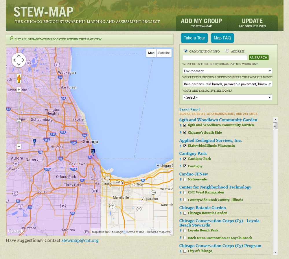
STEW-MAP
Client: U.S. Forest Service
STEW-MAP is a research project mapping organizations doing environmental stewardship work in the four-state Chicago Wilderness region.
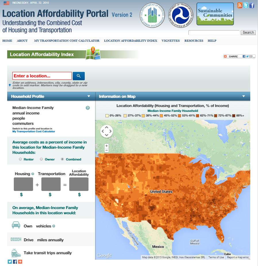
Location Affordability Index
Client: U.S. Department of Housing and Urban Development and Department of Transportation
In 2013, HUD and DOT announced the launch of the Location Affordability Index, a national index and web-based tool that estimates the cost of housing and transportation based on location.
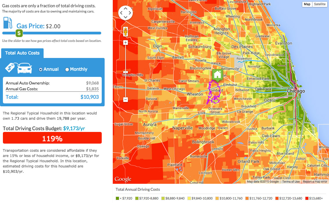
Total Driving Costs
Gas costs are only a fraction of total driving costs. The majority of costs are due to owning and maintaining cars.
TOD Database
The National Transit-Oriented Development (TOD) Database is a tool that provides economic and demographic information for every existing and proposed fixed guideway transit station in the U.S.